
MARTIM LONGO
37° 26' 21" N; 7° 45' 57" W
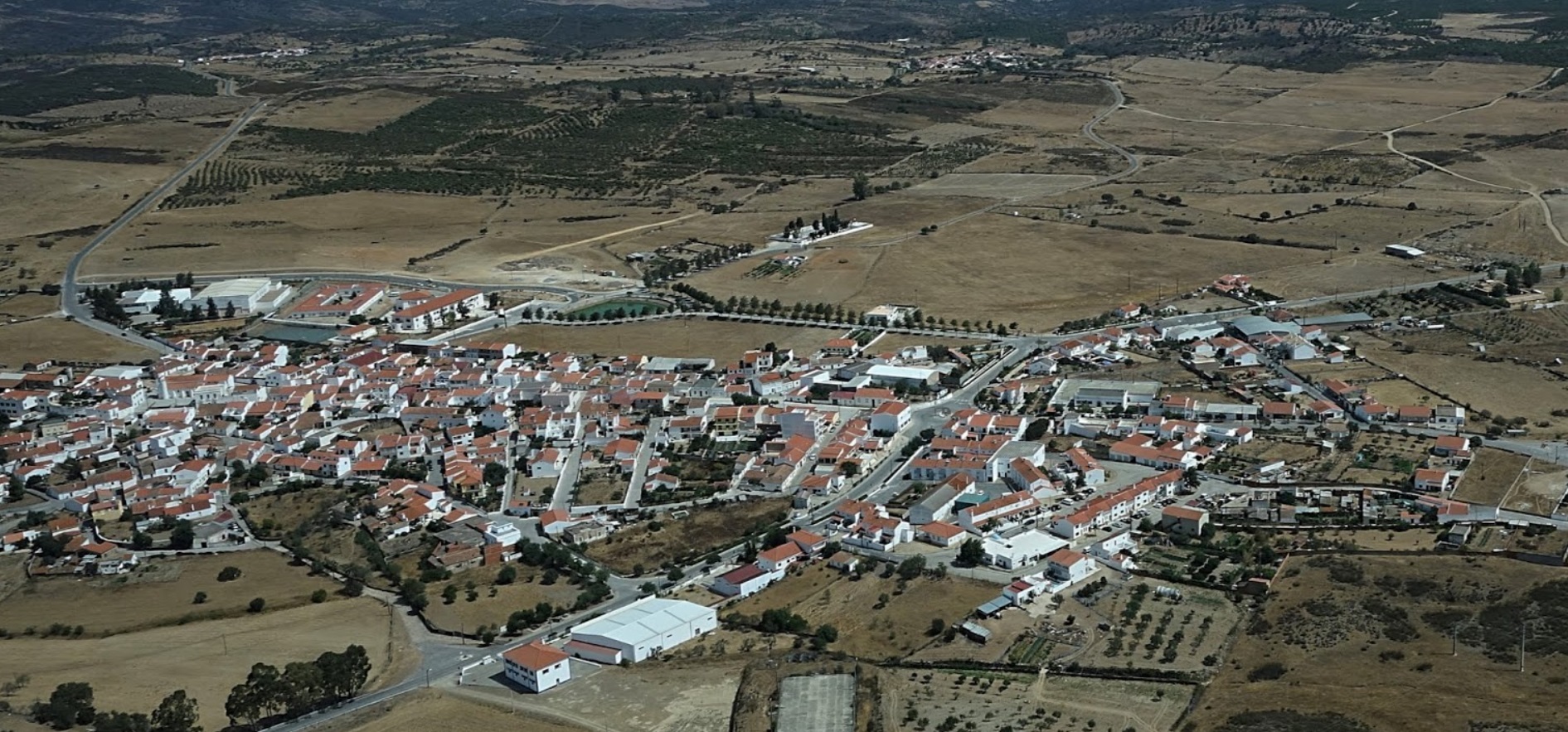
Martim Longo, also known as Martinlongo or Martilongo, is a Portuguese parish in the municipality of Alcoutim, with an area of 134.1 km² and 928 inhabitants (2021 census). Its population density is 6.9 inhabitants/km², which allows it to be classified as a Low Density Area (ordinance 1467-A/2001).
Martinlongo denotes human occupation from remote periods, even presenting some Roman archaeological remains, having its peak later in the 16th century, when it was the most important location in the municipality of Alcoutim, with a strong textile industry.
The peaceful parish is proud of its 16th-century main church, the hermitages of Espírito Santo, São Sebastião or Santa Justa, and also the museum centers in Santa Justa and Barrada, dedicated to the ethnology of this interesting region, full of tradition and customs that are important to preserve.
One of Martinlongo's greatest heritage assets is its rich handicrafts, namely the Wool Blankets and the very famous Jute Dolls, or cork miniatures.
Economy
The parish is famous for the production of various food products, such as a type of bread baked in a wood oven, and Martim Longo bread, with three industrial units. It also has the only cereal bar unit in Portugal, Alsnacks Energybar, a pioneering company in natural production that manufactures its own brand and private brands and is also a pioneer in the manufacture of bars with Konjac soluble fibers in the world. It also has the largest photovoltaic park, one of the largest in Europe, (there are two solar parks with an installed capacity of 220 megawatts), continuing to lead the European Union.
Patrimony
Cerro do Castelo de Santa Justa or the Chalcolithic settlement of Cerro do Castelo
Martim Longo Church
Tolo da Eira dos Palheiros
Tolo do Cerro do Malhanito
The following towns and places are in the municipality of Martim Longo:
Arrizada; Azinhal; Barrada; Barroso; Casa Nova do Pereirão; Castelhanos; Chada de Ouro;
Corte Serrano; Diogo Dias; Estrada; Fincia Rodilha; Laborato; Lotão; Lotão de Baixo;
Lotão de Cima; Martinlongo; Mestras; Montargil; Monte Laborato; Monte Novo do Pereirão;
Penteadeiros; Pereirão; Pêro Dias; Pessegueiro; Santa Justa; Silgado; Tremelgo de Baixo
Tremelgo de Cima


💓💓💓💓💓

VAQUEIROS (ALCOUTIM)
37° 23' 07" N; 7° 43' 40" W
Vaqueiros is a Portuguese parish in the municipality of Alcoutim, with an area of 143.94 km² and 333 inhabitants (2021 census). Its population density is 2.3 inhabitants/km², which allows it to be classified as a Low Density Area (ordinance 1467-A/2001).
In addition to religious heritage, as a point of interest, it has a museum, the Núcleo Museológico de Vaqueiros, also known as Núcleo Museológico Vidas do Campo.
Another point of interest is the themed Parque Mineiro da Cova dos Mouros.
The Odeleite stream, a tributary on the right bank of the Guadiana, passes 4 km south of Vaqueiros.
Religious heritage
Vaqueiros Mother Church
Chapel of São Bento
See also
Pão Duro
Cova dos Mouros Mining Park
Alcaria; Alcaria Queimada; Alcarias; Balurquinho; Barranco; Bemposta; Bentos; Cabaços;
Casa Nova; Casas; Fernandilho; Ferrarias; Fortim; Galachos; Galego; Jardos; Madeiras;
Malfrade; Monchique; Montinho da Revelada; Montinho da Várzea; Pão Duro; Pomar; Preguiça;
Preguiças; Taipas; Traviscosa; Vale da Rosa; Vaqueiros; Várzea; Zambujal.


💓💓💓💓💓
SEARCH IN ALPHABETICAL ORDER
IN THE DISTRICT OF FARO

💓💓💓💓💓
Return to mainland Portugal &
the Azores and Madeira islands

