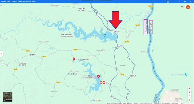
ODELEITE
37° 20' 4" N; 7° 29' 16" W
Odeleite is a Portuguese parish in the municipality of Castro Marim, with an area of 142.24 km² and 576 inhabitants (2021 census). Its population density is 4 inhabitants/km², which allows it to be classified as a Low Density Area (ordinance 1467-A/2001).
History
In keeping with the history of the entire district, Odeleite was probably also a prehistoric settlement area before it became part of the Roman province of Lusitania. After the invasion of Germanic tribes in the 5th century AD, the Moors conquered the area in the early 8th century. They maintained an agricultural production unit (Qarya) in what is now Odeleite. The current place's name also goes back to the Arabs, who called the river that runs here wdi al-laban (Port.: Rio de Leite, German: river of milk). In the course of the Reconquista, Paio Peres Correia conquered what is now the district of Castro Marim in 1242, and King D. Alfonso III was given city rights for the first time in 1277.
Odeleite has been an independent community since the 16th century and has its church.
Culture and sights
The municipality's architectural monuments include various windmills, the cemetery, and the three-aisled parish church Igreja Paroquial de Odeleite (also Igreja de Nossa Senhora da Visitação) from the 16th century. The historic center of Odeleite as a whole is also a listed building.
The archaeological excavations of Alcarias de Odeleite trace the Arab agricultural production site (Qarya) that was established here in the 8th century.
Patrimony
Church of Our Lady of the Visitation
See also
Odeleite Dam
Odeleite's house
Odeleite Parish Church
Ribeira de Odeleite
💓💓💓💓💓
SEARCH IN ALPHABETICAL ORDER
IN THE DISTRICT OF FARO
💓💓💓💓💓
Return to mainland Portugal &
the Azores and Madeira islands


