PADERNE
N 37º 10' 34''; W 8º 12' 07''
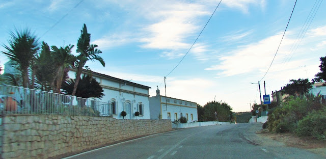
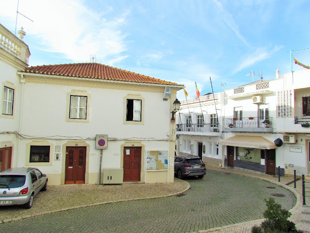
Paderne is a Portuguese parish in the municipality of Albufeira, in the district of Faro, and is located on the left bank of the Ribeira de Algibre or Quarteira, about 12 km from the county seat. With 52.56 k
m² of area and 3 304 inhabitants (2011), it has a population density of 62.9 inhabitants / km².
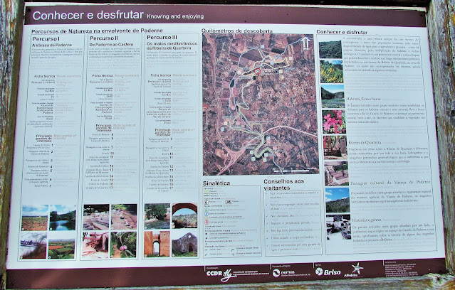
Heritage: Paderne Castle; Mother Church of Paderne; Medieval Paderne bridge; Watermill of Paderne; Chapel of Nossa Senhora do Pé da Cruz; Chapel of Nossa Senhora da Assunção; Casa da Paz and Fonte de Paderne, located on the road between Paderne and the Castle, and whose existence dates back to the 19th century. XVIII. The parish is traditionally sought after for its walking routes. In this are marked 3 routes with different degrees of difficulty. For lovers of hiking, the parish has three walking routes, duly marked.
These routes can be done on foot or by bicycle.
PR1 - 10.5 Km Castle Route
PR2 - 11.0 Km Cerro de São Vicente Route
PR3 - 12.0 Km Cerro Grande Route
NEW PHOTOS TAKEN IN 2024
CASTLE OF PADERN E
37°09′25″N; 8°12′02″ W
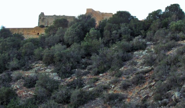
Around the middle of the 2nd century, the Roman conquered the Lusitanian Castro, which had developed between Neolithic and Chalcolithic. The settlement was transformed into a military outpost and, eventually, the politico-administrative center named Paderne or Paderna. Its location on a rocky peninsular bend was of strategic importance, as it controlled the ancient Roman road Via Lusitanorum crossing the Quarteira River on the south.
The Roman villa was conquered by the Moors by 713. On this site, the Almohads constructed a fortification. Concerned with advancing Christian armies from the north, the Almohads began an intensive period of military construction and fortification in the Algarve (in Paderne, Faro, Loulé and Silves, and many other locations). The depopulation of the Muslim countryside, caused by Christian raids, while avoiding outright conflict, resulted in the construction of these types of fortifications, which were used to secure relative safety for their citizens in the interior of the Algarvean Barrocal (mountains).
In 1189 the castle (Silves) was conquered by the armies of King Sancho I with the help of English-Christian mercenaries during a continuous night raid. In 1191 Muslim forces of the Almohad dynasty under the command of Caliph Abu Yusuf Ya’qub al-Mansur recaptured the castle and surrounding lands.
In 1248, D. Paio Peres Correia took the castle for the Crown of Portugal. The forces of Peres Correia massacred all its inhabitants within Paderne castle. It was shortly after these events that a chapel was built: it is believed that the structure was built on the ruins of the mosque.
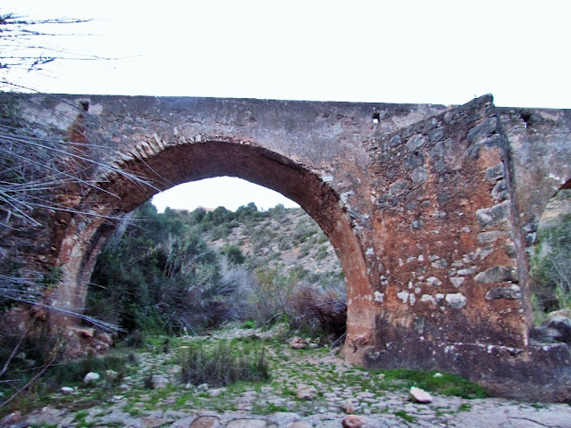
PADERNE MEDIEVAL BRIDGE
37° 09' 24.8" N; 8° 12' 00.6" W
Description and history
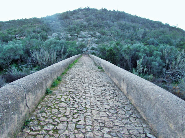
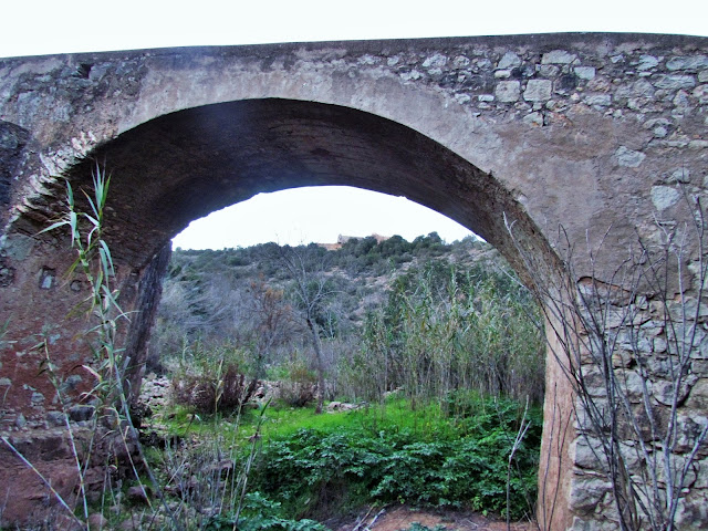
It has several similarities with Roman bridges, despite the structure being built much later. It is located approximately 200 m from Paderne Castle, in the southeast direction, and approximately 2250 m south of the village of Paderne. Cross the Ribeira de Quarteira. It is composed of a horizontal, rectangular deck, approximately 2 m wide, on three round masonry arches, supported by pillars, with the two on the central arch equipped with carvings in a triangular prism configuration.
The bridge was built during the Middle Ages and may be linked to a village whose remains were found nearby. It may have been built to serve Paderne Castle. In fact, the fortification was located in a location that allowed it to control the Ribeira de Quarteira and the bridge, thus controlling two important routes between the interior and the Algarve coast. The bridge underwent reconstruction work in 1771, a date that is inscribed on the central arch.
It is protected by the Special Protection Zone of Paderne Castle, published in Ordinance No. 978/99 of September 14th.
It was the subject of archaeological work in 1992, as part of the preparation of the Algarve division of the Archaeological Charter of Portugal, and between 2005 and 2006, during a program to survey the archaeological heritage of the municipality of Albufeira.
In 2002, an intervention was carried out to rehabilitate the historic bridge, with the consolidation of one of the structure's arches, partial repaving of the deck, restoration of the guardrail and break walls.
💓💓💓💓💓
SEARCH IN ALPHABETICAL ORDER
IN THE DISTRICT OF FARO
💓💓💓💓💓
Return to mainland Portugal &
the Azores and Madeira islands










.JPG)


